Archeology | Classical Wisdom Weekly - Part 3

Skip to Content

Category Archives: Archeology

[post_grid id="10060"]

The Only Library Ever Recovered from Antiquity

by May 3, 2018

By Wu Mingren, Contributing writer, Ancient Origins
Ancient Books

Fresco depicting a young man reading a scroll from Herculaneum

The Villa of the Papyri is the name given to a private house that was uncovered in the ancient Roman city of Herculaneum. This city, along with nearby Pompeii, is perhaps best remembered for its destruction during the eruption of Mount Vesuvius in 79 AD. Because of this natural disaster, the buildings of these cities were preserved under a thick layer of volcanic ash.
Drawing of the city of Herculaneum

1859 Imaginative drawing of the city of Herculaneum. ( Public Domain )

The Villa’s Elaborate Presence
One of these buildings was the Villa of the Papyri, named as such due to the discovery of a library in the house that contained about 1800 scrolls of papyri (known today as the ‘Herculaneum Papyri’), which were carbonized due to the eruption of Mount Vesuvius.
Villa Ruins

Ruins of the Villa of the Papyri in Herculaneum. (Erik Anderson/ CC BY SA 3.0 )

Researchers believe the Villa of the Papyri belonged to Lucius Calpurnius Piso Caesoninus, Julius Caesar’s father-in-law. This villa is located in the northwestern part of Herculaneum, on a slope of the volcano overlooking the Bay of Naples. Built in terraces down to the sea, the villa was a grand structure, covering an area of 30,000 square feet (2787 sq. meters). The front of the villa stretched for more than 820 ft. (250 meters), and offered its inhabitants an unobstructed view of the bay. The villa included two peristyles, a swimming pool, gardens, living and reception quarters.
Rediscovering the Villa
It was only during the 18th century that the villa was rediscovered. In 1709, the city of Herculaneum was rediscovered when workmen digging a well in the town of Resina stumbled upon the upper level of the ancient town’s theatre. Excavations began to be carried out and were funded by the House of Bourbon. In 1750, the Villa of the Papyri was uncovered, and an excavation was soon undertaken under the direction of Karl Weber, a Swiss architect and engineer.
Map of the villa

Weber’s map of Villa of the Papyri Herculaneum. ( Public Domain )

A Very Special Library
Two years later, in October 1752, the villa’s library was discovered, and with it, the first cache of papyri was brought to light. Containing about 1800 scrolls, the collection of this library is relatively small. Yet, it is the only known library to have survived from the Classical world.
Hence, the library has a great importance in the eyes of both archaeologists and classicists. Exposure to the volcanic gas and ash meant the scrolls were carbonized – they were turned into charred cylindrical lumps. In fact, the papyri were initially mistaken for lumps of charcoal or burnt logs, and their value was only recognized later. The carbonization of the scrolls effectively preserved them, though at the same time, it made them extremely difficult to unroll.
Papyrus found in Herculaneum

Herculaneum Papyrus 1428: Philodemus, On Piety. ( The Friends of Herculaneum Society )

A Difficult Process Begins
Attempts have been made to read the contents of these scrolls. Some were unceremoniously hacked open with a butcher’s knife, whilst others were simply unrolled. Needless to say, damage was done to the fragile artifacts. An ‘unrolling device’ was even invented by Antonio Piaggio, a Piarist monk, specifically for the unravelling of these papyri. Though the scrolls were unrolled with this device, they remained fragile, and the process took a very long time. The first scroll took four years to unravel.
Nevertheless, progress was being made, and by 1790, reports on the contents of the library were being published. Over the next two centuries, various techniques have been developed in the hope that the contents of the papyri may be accessed. Some of the most recent attempts involve digital, rather than physical, unravelling of the scrolls. In order to do so, methods such as X-rays, digital photography, and microscopy have been utilized.
However, it is still very difficult to view the writings on the papyri. The main problem is that the ink and the papyri are physically similar, as the Romans used a carbon-based ink made from smoke residues. In other words, it is not easy to differentiate the writings from the carbonized papyri.

The Mystery of the Roman Tunnels of Baiae

by April 27, 2018

By Ḏḥwty, Contributing Writer, Ancient Origins
There are certain places on Earth in which nature is imbued with the supernatural. Over the ages, human beings attach mythological stories to these places of mystery; one such place is located at the ancient Roman resort of Baiae.
Baiae is located in the Southern Italian region of Campania. Situated on the Bay of Naples, Baiae was a seaside resort for the wealthy inhabitants of Rome. Consequently, Baiae became notorious for the hedonistic lifestyle of its patrons. Over the centuries, however, local volcanic activity has caused much of the ancient resort to be submerged underwater. Although one could view the Roman ruins in the Baiae Archaeological Park, one would be required to take an underwater tour to fully comprehend the splendour of Baiae. Yet, Baiae was not merely a getaway for Rome’s super-rich. The hot springs that attracted Baiae’s patrons also gave it a mythical attachment.
Painting of Baiae by Turner

Baiae as seen by J. M. W. Turner. Image source: Wikipedia

In 1932, the entrance to a hitherto unknown antrum (chamber) was discovered by an Italian archaeologist, Amedeo Maiuri. As Maiuri and his team did not continue with their exploration after penetrating the tunnel for a couple of feet, the mystery of the antrum was left alone. It was only in the 1960s that the antrum gained attention again. This time, it was a British amateur archaeologist, Robert Paget, who explored the antrum. Along with an American colleague, Keith Jones, and a small group of volunteers, Paget began a decade-long excavation of the antrum. What he discovered was a complex system of tunnels.
Based on his findings, Paget speculated that this was the legendary ‘Cave of the Sibyl’ that was described by ancient authors. The Cumaean Sibyl, meaning the prophetess, is said to be a woman named Amalthaea who lived in a cave in the Phlegraean Fields, the area where the tunnel was found. According to legend, she had the power of prophesy, and scribbled the future on oak leaves scattered at the entrance of her cave.
Cumeaen Sibyl

Cumaean Sibyl by Andrea del Castagno. Image source: Wikipedia

During the reign of Tarquin the Proud, the last of the mythic kings of Rome, the Sibyl is said to have offered the king nine books/scrolls of prophesy for an extremely steep price. The king refused her offer, and the Sibyl left. When she returned, the Sibyl had six books/scrolls left, as she had three burnt. She offered the king the remaining books/scrolls for the same price, but Tarquin again refused. The Sibyl appeared for a third time with only three books/scrolls left, and the king finally accepted her offer. The books/scrolls were safely stored away in a stone chest in a vault beneath the Temple of Jupiter for hundreds of years after Tarquin’s reign.
These books/scrolls were only consulted when Rome was facing a crisis. The books/scrolls, however, were used as a ‘how-to’ guide for the performance of rituals that were believed to be able to avert the looming catastrophe.
Cumean sibyl with scrolls

The Cumaean Sibyl with her scrolls. Domenichino (1617 AD). Image source: Wikipedia

According to Paget, the features of the tunnel system suggest that it was constructed to mimic the visit to the mythical Underworld of the Greeks. For instance, the underground stream of sulphurous water may have represented the River Styx, which the newly dead had to traverse in order to enter Hades. As there was a ‘landing stage’ on one end of the stream, Paget speculated that a boat would have been waiting to ferry visitors across. At the end of the stream was a flight of stairs that led to a hidden sanctuary. Paget reckoned that the sanctuary would have housed someone posing as the Cumaean Sibyl.
Sulfur Drifts

Sulfur drifts from a vent on the barren volcanic plateau known as the Phlegraean Fields, a harsh moonscape associated with legends of prophecy. Photo: Wikicommons.

Along with other observations, Paget supposes that the tunnel system served a ritual purpose for the ancient Romans. Nevertheless, this interpretation is debatable.
Furthermore, there are numerous questions yet to be answered. For instance, no one knows for certain the builder(s) of these tunnels, and the time when they were built. What is certain is that the tunnels will continue to be a mystery until further evidence is found.

A Discovery That Shook the Archaeological World

by April 10, 2018

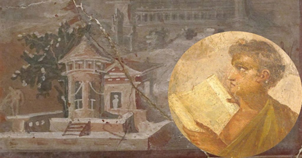
By Ryan Stone, Contributing writer, Ancient Origins
“A gentleman and a scholar.” There are few such men who fit this description from the “archaeological” community of the late 19th and early 20th centuries. There were certainly gentlemen and scholars, yet those who understood the rules and propriety of historical investigations and those who studied the histories themselves were not always one and the same.
Enter Sir Arthur John Evans: Oxford graduate, philologist, excavator and Keeper of the Ashmolean Museum. Today he is best known for his contributions to pre-Classical Aegean archaeology through his discovery of the Minoans. Yet how this man came to discover an untouched society, what and who inspired him, and—most importantly—which of his postulations were accurate and which false are as important to the examination of his research as the discovery itself.
The Ancient Cretean Archaeologists
Sir Arthur Evans’ predisposition for classical era research and Homeric literature was furthered by the “revolutionary” efforts of Heinrich Schliemann at Troy in the late 19th century. Though now scholars have determined that Schliemann’s success at Troy damaged more than it salvaged, archaeology was not yet a discipline when Schliemann’s efforts began. It was merely a hobby of the rich and elite—those who could afford trips to far off places, fancy devices for use in investigations, and the paychecks required by mercenary diggers and tour guides. His damages, however, are considered in part why archaeology developed into a proper scholarly practice.
Schliemann’s work at Troy and at Tiryns, where he “discovered” the Mycenaean civilization that he associated with the Trojan War, inspired Evans’ to turn away from his Italian, British and Balkan research, and toward the archaeology of the Aegean. However, Evans’ work is far more respected than Schliemann’s, due to his background—both in academics and political negotiations—and methodology.
Painting of Sir Arthur Evans

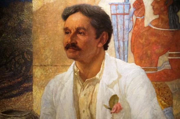
Portrait of Sir Arthur Evans by William Richmond, 1907 (Ashmolean Museum)

The Ashmolean Minoan Collector
Evans’ was well versed in art, history and philology, having made a name for himself as the author of many scholarly articles before he was entrusted as Keeper of the Ashmolean Museum—a job he would not have been hired for lightly. Under the employ of the Ashmolean Museum, Evans’ Aegean investigations began while attempting to transfer private collections of ancient artifacts (i.e. the Fortnum collection) to the Ashmolean.
It was under Evans’ advisement that the museum as a whole transitioned into one focused on art and archaeology, and began the assemblage of what would become the greatest Minoan collection outside of Crete. The success of this transition and the untimely death of Evans’ wife led to a shift in Evans’ interests, this time away from the museum and towards physical excavation.
In a moment of great insight during a visit to the island, Evans’ purchased the land where he would uncover the palace complex at Knossos. Within three years he had achieved a great deal, exposing Minoan frescoes, writing and numerous rooms within the complex.
Conversely, it was his future attempt at reconstructions of an unknown civilization, with a to-this-day untranslatable language, that is of concern.
Ruins at Knossos


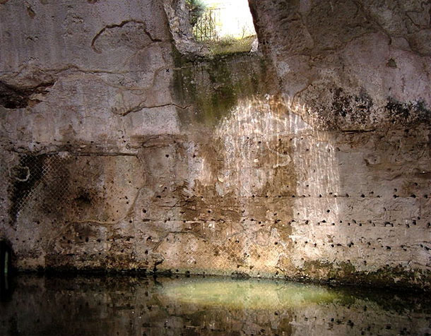
The palace complex ruins at Knossos

Evans’ Blurred Vision for Reconstruction of Knossos
Much like the man himself, the reconstruction Evans directed at Knossos could be described as short-sighted. In reconstructing his belief of what the complex at Knossos looked like in the Bronze Age, Evans inadvertently caused some damage like Schliemann did at Troy, though his intentions were for academic preservation and thus, he did not use dynamite.
At the time of his reconstruction (c. 1922), the name “Minoan” was borrowed from the Greek myth of King Minos and the Minotaur, and the various levels of construction were not accurately defined. (Such was the problem with Schliemann: his dynamite blasted through layers of Trojan culture before discovering that which has been determined as contemporary with Homer’s.)
A simple example of Evans’ miscalculation is his creation of the red, Minoan columns. There is no evidence that dark red columns—themselves constructed out of 20th century materials rather than what would have been used in the Bronze Age—looked as Evans depicted them. These Minoan columns were based on Greek models (despite the fact that the Greeks themselves borrowed the idea from older cultures), mounted on bases with capitals that resemble the Greek Doric style. Yet the Minoans likely had columns made from tree trunks, uprooted from the ground and flipped on their heads so the bottom of the tree held up the roof while the top of the tree served as the base.
Palace of Knossos reconstruction

Often criticized reconstructed red ‘Minoan’ columns at Palace of Knossos

Another concern of scholars is the restoration efforts of Evans and his team on the frescoes in the various “rooms” of the complex: the Throne Room, bathing room, etc. Though the color choices are believed to be relatively accurate based on comparisons with contemporary cultures and the natural ingredients in the area, the exactness of the frescoes is questioned. Scholars argue most fervently that Evans’ likely supplanted a “template” found intact at one wall to others as well, thereby incorrectly restoring the frescoes and injuring whatever symbolism had been intended by the original fresco and its location within the palace. (For example, the Tomb of the Diver in Paestum is believed to depict a diver as a metaphor for the transition from life to death. If the frescoes had a similar meaning in their particular locations at Knossos, that meaning has been covered by Evans’ restorations.)
Ancient Knossos Throne room

Throne room at Knossos with restored/reproduced frescoes

Evans’ Discoveries
Yet we do not wish to discount the strides Evans did contribute to understanding the culture known as the Minoans. One of the best iterations of his successes lies in his theory of bull-worship. This hypothesis was based on the numerous depictions of bull-leaping and prominent displays of the “Horns of Consecration” (also named by Evans).
Both before and during his tenure on Crete, Evans investigated the significance of the bull alongside images of a double-axe, the mystery of each leading him from Oxford to Crete in search of their original cultures in the first place. (In fact it is believed that finding the double-axe on Knossos convinced Evans that the site was worth purchasing and exploring.) Evans continued his investigations throughout his time on Crete, and he is credited with the preliminary understanding of what is believed to be Minoan religion.
Restored building

Restored building and frescoes at Knossos

Furthermore, Evans’ examination of bull-leaping frescoes led to the first somewhat defined chronology of the Minoans. Evans’ research of the frescoes insofar as dating, depictions, etc. led to the breakdown of the Minoan era into smaller periods similar to the Egyptian kingdoms—rather than Old, Middle and New.
The Minoan timeline is broken into Early, Middle and Late, and then further fragmented from there. Recent scholars such as John Younger have determined Evans’ religious assumptions and his chronological estimation of the practice of bull-leaping were both relatively accurate, and it is these initial parameters that allowed research into the Minoan period to propel forward rather than stagger.
Famous Bull leaping fresco

Bull leaping, fresco from the Great Palace at Knossos, Crete, Heraklion Archaeological Museum

Despite the questionability of early archaeological methods—if the practice can be called such under Evans and Schliemann—the discoveries of the early 20th century began investigations of what would become some of the most fascinating ancient mysteries. Though more is still unknown than known of the Minoan culture—including what they might have called themselves—without Evans’ shrewd work at the Ashmolean Museum, and his extensive academic background at Oxford, he might not have discovered the complex at Knossos. He might have been just another rich history fanatic, waving around Homer’s works while placing dynamite in strategically destructive places.
Schliemann was successful in such efforts, but there is no guarantee Evans would have been too. Without Evans’ foresight and determined attempts to understand the pre-Mycenaean civilization, an understanding of the culture—assuming it was still discovered—might have been set back decades.
Bibliography
Chaniotis, Angelos. 1999. From Minoans farmers to Roman traders: sidelights on the economy of ancient Crete . Stuttgart: Steiner.
Davis, Jack L., Vasiliki Florou, and Natalia Vogeikoff-Brogan . 2015. Carl W. Blegen: Personal and Archaeological Narratives. ISD LLC.
Evans, Arthur John. 1914. “The ‘Tomb of the Double Axes’ and the Associated Group and the Pillar Rooms and Ritual Vessels of the ‘Little Palace’ at Knossos.” Archaeologia. 65.1. pp.1-94. Accessed July 27, 2017.
https://digi.ub.uni-eidelberg.de/diglit/evans1914/0021?sid=4d5171c9f3498b7399864c2eb2aac0e8
Hamilakis, Yannis. (ed.) 2002. Labyrinth Revisited: Rethinking ‘Minoan’ Archaeology. Oxford: Oxbow Books.
MacEnroe, John. 1995. “Sir Arthur Evans and Edwardian Archaeology.” The Classical Bulletin . 71.1. pp. 3-18.
MacGillivray, Joseph Alexander. 2000. Minotaur: Sir Arthur Evans and the Archaeology f the Minoan Myth. New York: Hill and Wang.
Rubalcaba, Jill and Eric Cline. 2011. Digging for Troy: From Homer to Hisarlik . Charlesworth.
Stokes, Lauren. “Trojan wars and tourism: a lecture by C. Brian Rose”. Swarthmore College Daily Gazette. Accessed July 29, 2017.

The Lovers’ Coin

by April 7, 2018

by Brittany Marie Garcia
The story of Marc Antony and Cleopatra is a love story of seduction, exotic locations, love-triangles, family, politics, war, and suicide. And, just to make it more interesting, their tumultuous affair is connected to the rise and fall of both the Roman and Egyptian empires. And so, it is easy to see how this relationship has been an intriguing tale for centuries – with examples from Plutarch’s retelling to Elizabeth Taylor’s portrayal to the HBO Rome Series.
While there are countless images representing the romantic and tragic lives of Marc Antony and Cleopatra, there is an extraordinary, newly found item that perhaps shines a new light on the infamous couple… and it comes in the shape of money.
A recent archaeological discovery in Tel Bethsaida (Northern coast of the Sea of Galilee) yielded a coin with the images of these notorious lovers.
This curious coin, despite its discovery in Tel Bethsaida, was actually minted in the port of Akko (known today as Acre) in the last half of 35 BCE and/or the first half of 34 BCE. Made of bronze, the coin is only the approximate size of a quarter (21-23 millimeters in diameter).


But let’s delve into the details of this fascinating currency.
On Cleopatra’s side of the coin, one can see the Greek word: ΠΤΟΛΕΜΙδΣ. This word is in the genitive form of the noun ‘Ptolemais’, which means: “of the people of Ptolemais.” Just to bring it full circle, ‘Ptolemais’ is the name for ancient Akko, which you may remember is the location of where the coin was originally minted.
So why would the city of Akko coin metal representatives of Cleopatra and Marc Antony?
Dr. Ariel, head of Israel Antiquities Authority Coin Department, has an answer for this: “The cities of the ancient Middle East had a habit of minting coins bearing the portraits of whoever was in power”. In the time of 35 BCE Antony had had a recent victory over the Parthians (peoples from Northeast Iran and Armenia) as well as had bestowed Armenia to Cleopatra’s sons and Cyprus to her daughter. These events may indicate why the ancient Middle East considered him powerful.
This would lead us to think that there would be a lot of coins with Cleopatra and Antony. However, this is not the case.
Dr. Ariel continued, “Coins with the portraits of Antony and Cleopatra are extremely rare. Only six have been found anywhere in the world.” According to the ancient numismatic reference site Wildwinds.com though, there have been more than six discoveries of Antony and Cleopatra coins. It would stand, however, that only six of the eight coins found are in good condition. The coin recently discovered in Tel Bethsaida would make the seventh.
It has to be asked again then, if the ancient Middle East considered Antony and Cleopatra powerful in 35 BCE (and perhaps other years as well) then why are there not more of these “lovers’ coins?”

‘The Battle of Actium, 2 September 31 BC’ (1672) By Laureys a Castro

Of course we cannot be completely certain of the reason, but it is not difficult to hypothesize that Augustus Caesar may have had them collected and destroyed after his victory at Actium. After all, Augustus did destroy Antony’s portraits after his death. For some reason, however, Augustus allowed Cleopatra’s statues to remain in Caesar’s Temple to Venus Genetrix. Perhaps Augustus admired Cleopatra. Even as a ‘foreigner’, her ambition, cunning, and wit made admiration understandable.
On the other hand, his unforgiving attitude towards Antony may have had to do with Octavia. Antony’s affair with Cleopatra was at the expense of Augustus’ sister and Antony’s wife, Octavia, as well as their children. Because Cleopatra was a foreigner it was understandable, even expected, that she was a less respectable being, but as a Roman male citizen, Antony’s actions were inexcusable.
This could have prompted Augustus to destroy any coin that represented the man who had broken such strong societal conventions. The result is only a few stray pieces that escaped the victor’s retribution.
Therefore it is these rare coins that provide us with a look into Antony and Cleopatra’s policy on their representation, including the portrayal, features, and idealized form. It is uncertain whether they wished to emulate a certain presence, as is suggested by the British Museum, “Antony was said to remind people of the Greek hero Herakles in paintings and sculptures, with ‘… a very good and noble appearance; his beard was not unsightly, his forehead broad, and his nose aquiline’” (Plutarch, Life of Antony, 4).
However, his portrait in the coin seems to have picked up Ptolemaic features, specifically the strong projecting chin of Ptolemy I, the founder of Cleopatra’s dynasty, and the hooked noses of Cleopatra and her father Ptolemy XII.
Maybe this was a reason for the coins to be destroyed? Does it reveal something new about Marc Antony or does it show the bias of the minter in the city of Akko, which was founded by Ptomlemy II Philadelphus in the 3rd century BCE?
We’ll never completely know, but what is certain is that this infamous couple continues to engage, fill, and plague our minds. Though they are long dead and their story known by most, they do not cease to be the topic of much discussion, debate, and obsession.

Built to Last: The Secret that Enabled Roman Roads to Withstand the Passage of Time

by March 27, 2018

By Wu Mingren, Contributing Writer, Ancient Origins
The Romans were renowned as great engineers and this is evident in the many structures that they left behind. One particular type of construction that the Romans were famous for is their roads. It was these roads, which the Romans called viae, that enabled them to build and maintain their empire. How did they create this infrastructure that has withstood the passing of time better than most its modern counterparts?
Roads of All Kinds
It has been calculated that the network of Roman roads covered a distance of over 400,000 km (248,548.47 miles), with more than 120,000 km (74,564.54 miles) of this being of the type known as ‘public roads’. Spreading across the Romans’ vast empire from Great Britain in the north to Morocco in the south, and from Portugal in the west to Iraq in the East, they allowed people and goods to travel quickly from one part of the empire to another.
The Roman Empire Map

The Roman empire in the time of Hadrian (ruled 117–138), showing the network of main Roman roads. (CC BY SA 3.0)

The Romans classified their roads into several types. The most important of these were the viae publicae (public roads), followed by the viae militares (military roads), then the actus (local roads), and finally the privatae (private roads). The first of these were the widest, and reached up to 12 meters (39.37 ft.) in width. Military roads were maintained by the army, and private roads were built by individual landowners.
Examples of Roman Roads


Two examples of ancient Roman roads: one at Leptis Magna, Libya (top) (CC BY-SA 3.0) and another at Santa Àgueda, Minorca (Spain) (bottom). (Public Domain)

Constructing Roads to Last
There was no ‘one-size-fits-all’ Roman technique for building roads. Their construction varied depending on the terrain and the local building materials that were available. For example, different solutions were required to build roads over marshy areas and steep ground. Nevertheless, there are certain standard rules that were followed.
Trajans Column

Scene on Trajan’s Column showing Romans felling trees for road construction. (CC BY SA 3.0)

Roman roads consisted of three layers – a foundation layer on the bottom, a middle layer, and a surface layer on the top. The foundation layer often consisted of stones or earth. Other materials used to form this layer included: rough gravel, crushed bricks, clay material, and even piles of wood when roads were being built over swampy areas. The following layer would be composed of softer materials such as sand or fine gravel. This layer may have been formed by several successive layers.
Finally, the surface was made using gravel, which was occasionally mixed with lime. For more prominent areas, such as those close to cities, roads were made more impressive by having the surface layer built using blocks of stone (which depended on the local material available, and may have consisted of volcanic tuff, limestone, basalt, etc.) or cobbles. The center of the road sloped to the sides to allow water to drain off the surface into drainage ditches. These ditches also served to define the road in areas where enemies could use the surrounding terrain for ambushes.
Layers in a Roman road

Possible layers in a Roman road. (Crystalinks)

Pathways to Trade and Cultural Exchange
Roads played a crucial role in the Roman Empire. For a start, the roads allowed people and goods to move swiftly across the empire. For example, in 9 BC, using these roads, the future emperor Tiberius was able to travel almost 350 km (217.48 miles) in 24 hours to be by the side of his dying brother, Drusus. This also meant that Roman troops could be deployed rapidly to various parts of the empire in the event of an emergency, i.e. internal revolts or external threats. Apart from allowing the Roman army to outmaneuver their enemies, the existence of these roads also reduced the need for large and costly garrisons throughout the empire.
In addition to serving a military purpose, the roads constructed by the Romans also enabled trade and cultural exchange to occur. The via Traiana Nova (known before that as the via Regia), for instance, was built on an ancient trade route that connected Egypt and Syria, and it continued serving this purpose during the Roman period. One of the factors that allowed such roads to facilitate trade is the fact that they were patrolled by the Roman army, which meant that merchants were protected from bandits and highwaymen.
Another function of roads in the Roman world is perhaps an ideological one. These roads may be interpreted as a mark left by the Romans in the landscape, signifying their conquest of the terrain and the local population.
Roman Soldiers on the road

Illustration of Roman soldiers patrolling or traveling on a road. (Crystalinks)

Incredible Construction: Greek Acropolis Built by Ancient Engineers to Resist Earthquakes

by February 21, 2018

By Liz Leafloor, Contributing Writer, Ancient Origins
Throughout its 2,500-year history, the ancient ruins of the Acropolis in Greece managed to survive many earthquakes where other, more modern constructions have fallen. How is this possible? Experts now conclude it comes down to skillful construction and accomplished engineering.
Kyriazis Pitilakis, Professor of Civil Engineering Department of the Aristotle University of Thessaloniki tells news site Greek Reporter, “This is an incredible construction, using ingenious solutions to insurmountable engineering and construction problems.”
Scientists and engineers, puzzled by how the ancient buildings survived the many regional earthquakes, examined the construction of the famous Parthenon and the Athenian citadel in total. Based on their findings, they concluded that the buildings were designed specifically in order to be protected from earthquakes.
At a workshop on “Contemporary Interventions in the Athenian Acropolis Monuments” organized by the Department of Civil Engineering, Pitilakis said “The modular columns, other than the fact that they were made to be constructed and transported more easily, they are designed so that they have excellent seismic performance properties.” In effect, the columns were built to withstand earthquakes.
Erechtheion

The Erechtheion, ancient Greek temple at the Acropolis of Athens. It was dedicated to Poseidon and Athena. Juan Manuel Caicedo/ Flickr

It would seem the ancient engineers knew what they were doing in terms of ensuring their creations would last, which is part of the reason we still see them gracing the high, rocky outcrop in Athens.
The Acropolis of Athens, proclaimed the “preeminent monument” on the European Cultural Heritage list of monuments, is a sprawling citadel composed of many structures, including the famous Parthenon. Evidence suggests the site was inhabited as early as the fourth millennium B.C., and it has suffered damage due to wars and fire in its long history. Incredibly, the Parthenon was being used to store gunpowder, and a cannonball strike caused a blast that severely damaged the structure in 1687.
Parthenon-greece-acropolis

Famous ancient Greek structure, the Parthenon at night. Andreas Kontokanis/ Flickr

Acropolis-of-Athens

The Acropolis of Athens, as seen from Philopappou Hill. A. Savin/Wikimedia Commons

Pitilakis explained the importance of the enduring historic site in Athens, saying “The Parthenon condenses all that Greece is and all that it has offered to the Western World in the best way. It stands as a symbol of European culture, a symbol of the principle of measure, of art, technology and human capability. This is because that other than the highest artistic creation, it is also a marvel of mechanical engineering.”
Efforts began in 1964 by the Greek government in restoring the Acropolis, and teams of archaeologists, architects, civil engineers and chemists work to preserve the important cultural and historical icon.
The World Cultural Council writes of the award-winning restoration by the Athens Acropolis Preservation Group of Greece, observing, “Most of the marble comes from the Greek islands, where there is an age-old tradition of working marble; they now continue the work of their ancestors, using the same methods and same tools, not indeed to create but rather to save a masterpiece which belongs not only to the Greeks but to all humanity.”